ForeFlight - Aeronautical Maps

FOREFLIGHT - GLOBAL AERONAUTICAL MAPS: PROCESS
OBJECTIVE
While scans of paper charts was once cutting edge, it required zooming in to levels that made it difficult to use during flight when pilots need to see the bigger picture. By creating a map that can be used to see that larger picture, we can provide a greater level of data to pilots.
PROCESS
This project began by gaining an understanding how printed or scanned navigational charts were designed and used in flight. By starting here, I was able to gain an understanding of what worked well and pain points for pilots. While some of this was easily inferred, by talking to pilots with a range of experience from 10 to 17,000 hours, I was able to focus on areas that were important, like bringing in information are earlier zoom levels to allow pilots to see more information further out.
A large part of the project scope was to provide minimal changes to the styling and design used on paper charts because we wanted to reduce downtime to learn and these charts were already committed to memory and could throw a pilot off inflight which could be a potential safety risk. To keep it familiar, I took inspiration existing designs for icons, line styles, and patterns and enhanced areas that needed to be easier to view at a glance, were optimized for digital, and could be viewed in various lighting conditions.
To test this, I did not strictly design from my desk, but actively walked around in various sky conditions, holding my iPad at various angles, to determine the best colors for the three different themes taking into account glare and ambient light. I also spent time in dark rooms (mainly closets and bathrooms) to understand how color could effect vision during night flight. These types of study lead me to create 2 additional map themes to compliment the previous default theme. Users now have the option to use Light, Dark or Classic modes which changes not only the colors of the base map, but various elements on each theme to make them standout better from their corresponding backgrounds.

Example of a pilot in flight using a paper chart. The 1:500,000 scale Sectional Aeronautical Chart Series is designed for visual navigation of slow to medium speed aircraft.
RESULTS

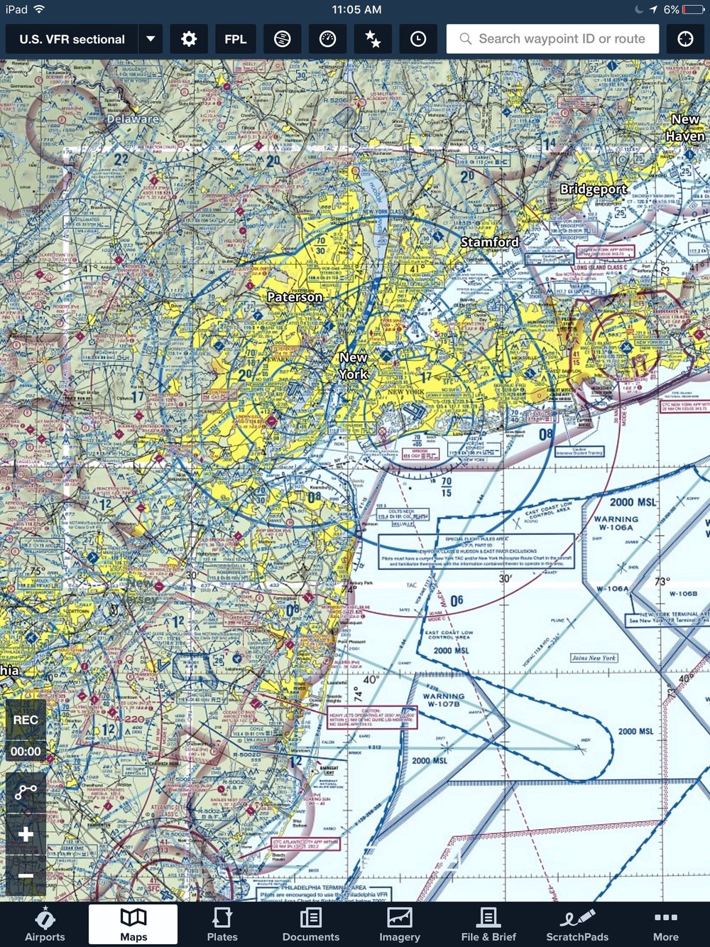
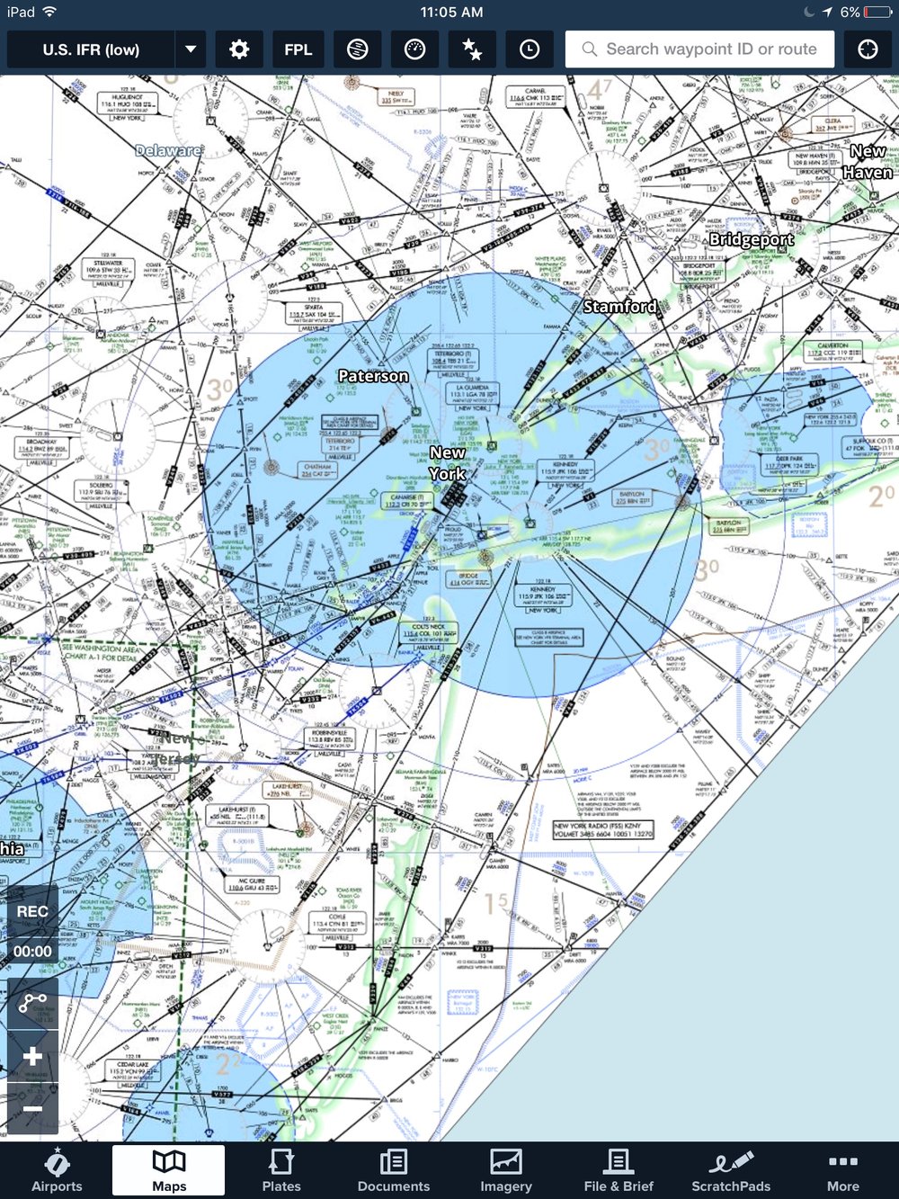
ForeFlight Global Aeronautical Maps

FAA issued VFR (Visual Flight Rules) Sectional

FAA issued IFR (Instrument Flight Rules) Enroute Charts
RECEPTION
When ForeFlight 8.0 was released in the end of August 2016, the feedback was almost overwhelming. From positives to negatives, the views of users was all over the map. This is fairly common when releasing a new way of doing things. In talking with users, it seems that the concerns boil down to relearning something they have used for a long time, not having every element found on paper charts, and the fear that what they were used to had been directly replaced. With help from both the ForeFlight Support and Marketing teams, many customers concerns were eased. In December of 2016, we released another major update, which added new elements that had been commonly requested and provided the most value in flight. We look to deliver more updates in 2017. This project is one that is on-going as new elements, use cases, and data pop up everyday.
IPHONE 2/3 VIEW
A key to success for Aeronautical Maps was to ensure that the product on both iPhone and iPad were as similar as possible. This went beyond just the map and it's styling. It extended to detail views and how users interacted with settings as these were previously different than the iPad versions. The detail views were full screen and covered the entire map removing context. The settings view on the map was a single setting where the user could adjust opacity of overlays. By lowering the full height view to 2/3s, we gave the users access to the map and to view information related to the simultaneously.

Add to Route/Near By

Airport Details View

Waypoint Details View

Map Settings